

 Latest Tweets


Calderglen Country Park trail map
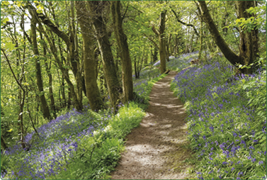
There are over eight miles of nature trail at Calderglen where nature lovers and ramblers alike can enjoy a walk through the woods or along the banks of the River Calder.
Calderglen has four official nature trails which all start from the Information Point at the top of the main drive.
Quick trail guide
| Trail | Distance | Time | Average calories | Elevation gain | |
|---|---|---|---|---|---|
| Gentle pace | Fast pace | ||||
| Tor | 1.6 miles | 50 mins | 30 mins | 155 | 128ft = 185 stairs |
| Calderwood Castle * | 2.5 miles | 1 hr 30 mins | 50 mins | 260 | 325ft = 470 stairs |
| South Bridge | 1 mile | 40 mins | 20 mins | 100 | 123ft = 177 stairs |
| Calderglen Langlands * | 2.5 miles | 1 hr 20 mins | 45 mins | 235 | 173ft = 250 stairs |
* Calderwood Castle and Calderglen Langlands trails are linear, and times and distance are one way. Burning 100 extra calories a day is equal to 10lb in weight over a year.
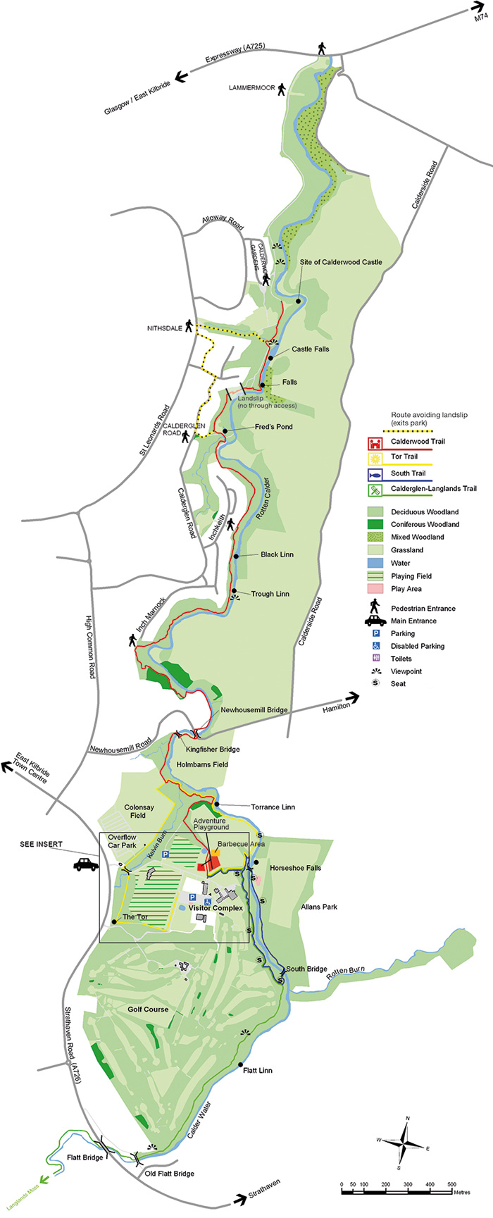
Calderwood Trail
The Calderwood Trail follows the red markers. It winds downstream along the banks of the Rotten Calder to the site of the former Calderwood Castle. There are good views of scenic waterfalls along the way, as well as colourful displays of woodland wildflowers in late spring. The history of the Calderwood Estate can be traced back as far as the 13th century. The castle in the adjacent picture, originally built in 1790, was the stately home of the Maxwell family. In 1845, the then owner, Sir William Alexander Maxwell, added the grand gothic frontage. The death of Sir William Alexander’s widow in 1900 marked the end of the Maxwell lineage. The castle subsequently passed through a number of owners, including the Scottish Co-operative Society who worked the land and opened the grounds to the public in the early 20th Century. Sadly, by 1951 the castle had fallen into such a state of disrepair that it had to be demolished. Traces of the formal gardens and the family Mausoleum are all that now remain of this once majestic country estate.
South Trail
The South Trail follows the blue markers.
This popular trail explores the steep wooded glen of the Rotten Calder River, formed by the Rotten Burn flowing into the Calder Water just above South Bridge (pictured). The river is actually very clean and not at all ‘rotten’ as its name suggests. The name is a corruption of a word meaning ‘red’ referring to the colour of the ironstone over which the Rotten Burn flows. Look out for dippers and grey wagtails bobbing about on stones on the river.
The South Trail is a 1.6km long circular route. Average walking time 30 mins.
Tor Trail
The Tor Trail follows the yellow markers. It passes through open meadow, as well as broadleaf and coniferous woodlands.
The trail follows the Rotten Calder then brings you back along the Kelvin Burn, crossing the main drive and back into the woodland. The trail takes its name from the Tor, a man-made mound dating from the Dark Ages, that can be seen en route. Tors were often built to mark burial or battle sites. Unfortunately, the origins of this one remains a mystery.
Calderglen - Langlands Trail
Following the green markers this trail leads you to Langlands Moss Local Nature Reserve. This rare and ecologically important raised bog site supports a unique range of plant
and animal life. A boardwalk running across the bog allows you a closer look at this interesting habitat.
The Calderglen - Langlands Trail is a linear route covering 4km each way. Average walking time 2.5 hours round trip.
The Calderwood Trail is a linear path that is steep in places. It is approximately 4km each way. Average walking time of 3 hours round trip.
© Crown copyright and database rights 2024 OS 100020730. You are permitted to use this data solely to enable you to respond to, or interact with,
the organisation that provided you with the data. You are not permitted to copy, sub-license, distribute or sell any of this data to third parties in any form.